Grass
-
Teaching CAD / GIS
Geographic Information Systems: 30 educational videos
The intrinsic geolocation in almost everything we do, using electronic devices, has made the GIS issue more urgent to apply every day. 30 years ago, talking about a coordinate, a route or a map was a matter…
Read More » -
Geospatial - GIS

Is Java Worth Learning?
Beyond OpenOffice, Vuze, Woopra, or the applets that are displayed on some web pages, it is well positioned in mobile systems, TV, GPS, ATMs, business programs and many of the pages that we browse daily are running...
Read More » -
Teaching CAD / GIS

What students think about Open Source Geospatial
This article is based on a presentation given at FOSS4G in Barcelona in September 2010 by: Iraklis Karampourniotis and Ioannis Paraschakis – from the Aristotle University of Thessaloniki Zoi Arvanitidou – from the University of the Aegean El…
Read More » -
ArcGIS-ESRI

118 themes from FOSS4G 2010
The best that can remain from these events are the PDF presentations that are very practical for reference in training or decision-making processes; more in these times than the open source geospatial world has…
Read More » -
ArcGIS-ESRI

Geoinformatics 1: Remote sensing
Geoinformatics arrives in its first edition in 2010, with a strong emphasis on remote sensing. Although the year is young, it seems that the next editions will maintain this line, including on this occasion two of the greats of the sector not…
Read More » -
Geospatial - GIS
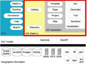
UDig, first impression
We have already taken a look at other open source tools in the GIS area before, including Qgis and gvSIG, apart from non-free programs that we have tried before. In this case we will do it with User-Friendly Desktop Internet GIS…
Read More » -
ArcGIS-ESRI

Geophysics: 2010 Predictions: GIS Software
A couple of days ago, in the heat of a stick coffee that my mother-in-law makes, we were hallucinating about the trends set for 2010 in the Internet area. In the case of the geospatial environment, the situation is more…
Read More » -
GvSIG

SEXTANTE, + 220 routines for gvSIG
Just as GRASS complements Quantum GIS, SEXTANTE does it with gvSIG, keeping the specialty. They are the best of collaborative efforts between open source alternatives in the geospatial environment, seeking to avoid duplication.…
Read More » -
Geospatial - GIS

GvSIG, which will be in the 5tas. journeys
A preliminary version of what could be in the fifth gvSIG conference to be held in the Valencia event center, from December 2 to 4, 2009, has already been announced. Much of the work to be presented is…
Read More » -
Teaching CAD / GIS

GvSIG courses in Valencia
Starting in the first quarter of 2010, the Florida University Training Center will be serving gvSIG courses, which to date have been taught as a complement to the Interior Tourism Specialist Diploma. The one with a duration of 20…
Read More » -
Geospatial - GIS
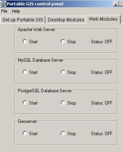
Portable GIS, everything from a USB
Version 2 of Portable GIS has been released, a simply wonderful application to run from an external disk, a USB memory and even a digital camera the necessary programs for managing spatial information both at the...
Read More » -
GvSIG
GvSIG: Profits from this and other trades
The way free tools have matured is interesting, a few years ago, talking about free GIS sounded like UNIX, in the voice of a Geek and at a level of mistrust due to fear of the unknown. All that has changed...
Read More » -
Geospatial - GIS

Quantum GIS, first impression
The article makes a first revision of Quantum GIS, without analyzing the extensions; doing some comparisons with gvSIG and other applications
Read More » -
Geospatial - GIS

Model for measuring the quality of Free Software
This document was published not long ago by the Department of Processes and Systems of the Simón Bolívar University and the National Telecommunications Commission of Venezuela CONATEL, I found out about this through the network of that…
Read More » -
Geospatial - GIS
Who moved my cheese?
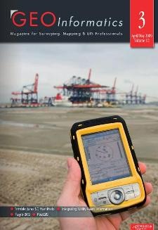
I really like Geoinformatics, apart from being a magazine with great layout taste, the contents are very good in geospatial matters. Today the April version has been announced, from which I have taken some texts highlighted in red...
Read More » -
Geospatial - GIS

What will be in the III Conference of Free GIS
The III Free SIG Conference will take place in Girona on March 11, 12 and 13, 2009, shortly after the Informatics Fair 2009 in Havana. On Friday the 13th will be the workshops…
Read More » -
ArcGIS-ESRI

Criteria for choosing GIS / CAD solutions
Today has been the day that has corresponded to me to present in the real estate cadastre course in Bolivia. The subject has been oriented to the reflection of how to choose a computer tool for a geomatic development. This is the graph...
Read More » -
ArcGIS-ESRI

Downloadable downloads for GIS users
Here is a list of downloads that are often very useful for users of CAD / GIS platforms. Some of them are not available for recent versions, but they are still a reference and it is worth keeping an eye on…
Read More »

