
Geospatial - GIS
Live - Hurricane Irma - Society gets used to interacting with geospatial
It is interesting how geospatial data is at the service of the masses every day, to the extent that some disciplines that were previously specialized, such as meteorology, now with the help of animated and explicit graphics require more than one skilled presenter. Although we are sure that the professionals of the field who are displaced, keep their frustration before some of the showmen who hardly repeat it like parrots.
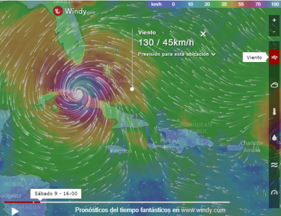
The example of the viewer embedded in this entry includes very interesting functionalities, connected to data fed, in a relative relation to the real time.
In the end, there is a gain that society is increasingly used to georeferencing. Everybody wins.


