
AulaGEO courses
Flood Modeling Course - HEC-RAS from scratch
Flood and flood analysis with free software: HEC-RAS
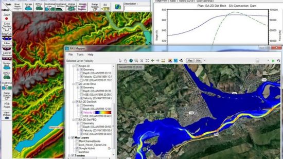
HEC-RAS is a program of the United States Army Corps of Engineers, for the flood modeling in natural rivers and other channels. In this introductory course you will see the process for the realization of one-dimensional models, although as of version 5 of the program, two-dimensional flow modeling has been incorporated, as well as the capabilities of sediment transfer modeling.
The course will advance through the entire process of generating the model: from the creation of geometry, analysis data entry, model execution, and data export.
It is a course eminently practical with the just and necessary doses of theory, where materials are provided to follow each lesson in real time.
HecRas is a program for the calculation of floods and floods.
What will you learn
- Know the use of HEC-RAS at the initiation level
- Understand the basic principles of hydrology and hydraulics used by the program
- Generate flooding models and interpret their results
Course Prerequisites
- Computer
- Basic knowledge of hydrology
- Software management at the initiation level
Who is the course for?
- Professionals who have to make flood models
- Interested in knowing new useful software for your professional career


