
Get altitudes of a route in Google Earth
When we draw a route in Google Earth, it is possible to make its elevation visible in the application. But when we download the file, it only brings its latitude and longitude coordinates. The altitude is always zero.
In this article we will see how to add to this file the elevation obtained from the digital model (srtm) that uses Google Earth.
Draw the Route in Google Earth.
In this case, I am drawing a point route between two extremes where I am interested in the profile.
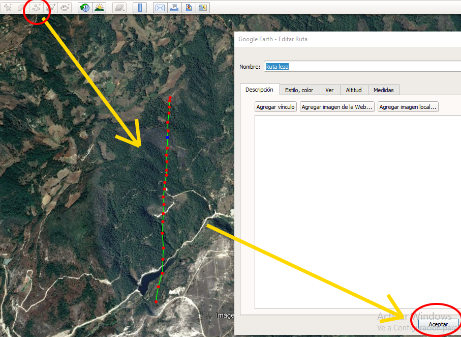
See the elevation profile in Google Earth.

To draw the profile, touch the path with the right mouse button and select the option “Show elevation profile”. This displays the lower panel where, as you scroll, the position and elevation are shown on the object.
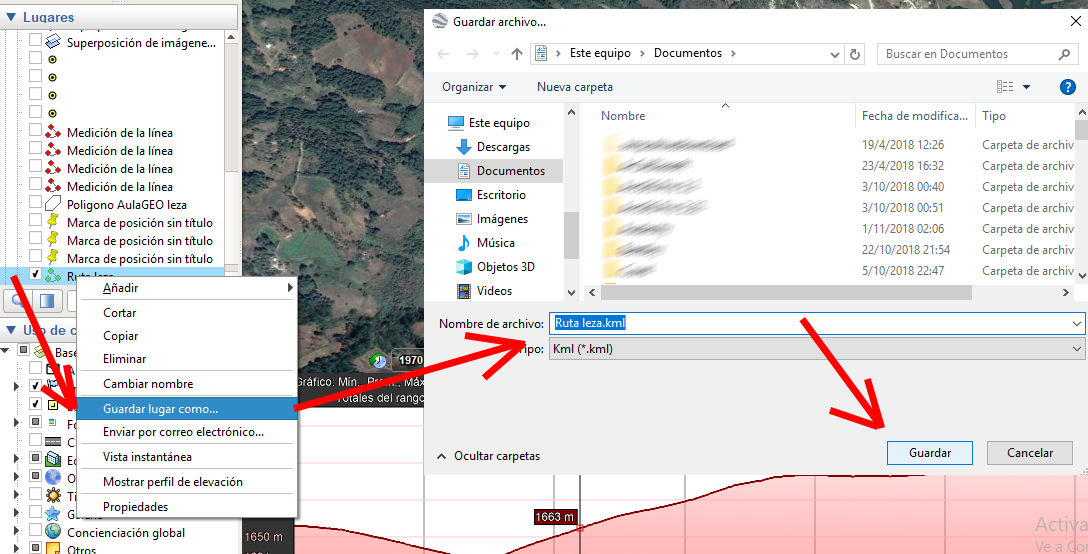
Download the kml file.
To download the file, tap on the side panel and with the right mouse button select "save place as...". In this case we will call it “Route leza.kml”, then we press the “Save” button.
The problem is to see this file, we realize that it goes down with the coordinates but without altitude. This is the file if we visualize it with Excel, see how the column ns1: coordinates has a list of all the vertices of the route, and its elevation is all at zero.

Get the elevation.
To obtain the elevation, we will use the program TCX Converter. Indeed, by opening the original kml we can see that the elevation is zero in the ALT column.
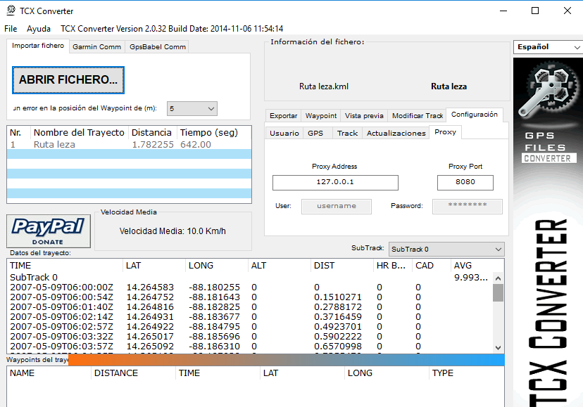
To obtain the altitudes, we select the “Modify Track” option, in the “Update altitude” button. A message will appear that says that an Internet connection is necessary and that the elevations that exist will be updated. Depending on the number of points the application could freeze but after a few seconds we can see that the altitude has been updated.

 Save the kml with elevation.

To save the kml with the elevations, we only select the “Export” tab, and choose to save the kml file.
As you can see, now the kml file has its altitude.
TCX converter is a free program that apart from being able to combine routes, you can export not only kml, but also routes .tcx (Training Center), -gpx (General GPX file), .plt (Oziexplorer PLT track file), .trk (CompeGPS file), .csv (can be seen in Excel), .fit (Garmin file) and also ploar .hrm.


baixei or tcx mais nao is updating as altitudes appears m>
or that I must be feito