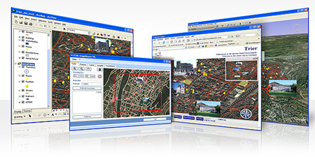
ESRI Image Mapper to publish maps
Among the best solutions that ESRI has released for 2.0 web is HTML Image mapper, with support for both 9x platforms and the old but functional 3x.
Before we saw some ESRI toys, which were never so good, especially because they insisted on keeping their WFS and WMS formats at their own standards.
Among its best characteristics, it is its authoring sequence, in which step by step the data origin, format of deployment, external channels and above all attributes are configured.
Let's look at the features they offer:
- Practical, Creation in minutes
- No knowledge of HTML code is required, although a few css tweaks help
- Can be exported directly from an 3x project
- Does not require crazy server configurations
- It can be published locally or to a storage disk ... and it works
- Eye ... support in 3x versions as an extension
I remember what it cost to do these things with Bentley's GeoWeb Publisher, even this can be done with manifold for a very low price but takes a lot of programming. Although this ESRI platform looks pretty easy, don't believe it at first, it always takes to solve some compatibility problems and javascript services, however it does not compare with the love of a mother.
Finally the output maps are very functional, they bring their basic menus of scrolling, displaying, searching and attributes.
Very well said in his advertising campaign: Concept and attributes: Keep them simple.


