
In GoogleEarth pro the images have better resolution?
Apparently there is some confusion about what the paid versions of Google Earth offer, some believe that better resolution coverages are obtained.
In effect, better resolution is obtained, but no more coverages than what we see, what these tools offer is better output quality, for example to see, print, save or send to pdf formats, although the coverage is the same.
Taking advantage of the post, let's see the differences between the four versions of Google Earth:
1 Google Earth, the free version is what you know ... or what the help says
2 Google Earth Plus
- It is for non-commercial use (price
$ 20 per year) - you can connect GPS and navigate in real time with NMEA (read only), although the compatibility is only with the GPS Maguellan and Garmin.
- You can measure routes
- You can import coordinate files into excel documents (.csv format), up to 100 points
- The way of handling the cache is different, so you can have an improved performance on the computer.
- Higher resolution printing. Be careful, it does not mean that more updated images are obtained, what it means is that the way the image is served is in a quality that we see on the google earth screen (including the anisotropic filter), which translates into a better image quality for printing or to send to pdf format via printer.
- Images can be printed at a resolution of 1,400 pixels, in the free version only up to 1,000 although in both versions the images can only be guaranteed at a resolution of 1,000 pixels.
- Local business ads are an option that can be hidden, both in this version and in the Pro.
- Support can be obtained via email, even if only with problems related to access.
By the end of the year 2008 Google eliminated the cost of this license and the features were included in the free version.
3 Google Earth Pro
It is for professional use (price $ 400 per license) in addition to the plus version has these features:
- Tools for measuring circles and polygons
- Style templates for setting thicknesses, styles, and frames for printer or plotter
- You can import coordinates (addresses) but up to 2,500, always in .csv format
- It has other email and chat features
- The performance of the equipment is much better than in the plus version.
- Very high resolution printing, again, for data output purposes, however the coverage of images you see is the same as in the free versions.
- Images can be printed and saved up to a resolution of 4,800 pixels… This is a lot.
- Support can be obtained via email.
- There are other features, such as creating movies, measuring areas and importing gis data.
- If you want to have traffic data (GDT) you must pay $ 200 extra.
4 Google Earth Enterprise Client (EC)
This is for companies that are interested in developing their own applications and interact with Google Earth data, for these there are some tools, among others:
- Google Earth Fusion To integrate data such as frames (images), GIS data, terrain data and point data.
- The Google Earth server With this you can send data streams to the client program (Google Earth EC).
- Google Earth EC (Enterprise Client) Allows you to view, print and create data.


It's good
Google earth pro costs $400 PER YEAR, it is an annual subscription, it is very clear on the google website. “Google Earth Pro is licensed for $400 as an annual subscription for an individual user.”
Do not get confused.
In this link you can buy the license
https://earthprostore.appspot.com/index.ep
I WANT TO KNOW HOW TO BUY THE LICENSE
The $ 400 is paid in a single installment, but it is a one year license. So if you want to keep it, you must renew it every year
I want to know if that 400 $ is paid monthly or annual ????????????
worth $ 400, is not a permanent license, but an annual subscription.
Nothing you ask for is like this in the paid version.
You see the same thing you see in the free version, you only have more resolution for printing purposes but they are the same coverages.
It is not possible for a system to show you data in real time, unless you have the money to have your own satellite.
I want to buy the 400us license but first I want to know if you are surfing in real time, if the location is clearer than the free one, and if I can see the areas that are not clearly seen in the free product, and how long the license lasts the renovation costs.
Lilis:
I do not know how you can do that in Google Earth
HOW IT CAN BE HIGHLIGHTED A POLIGONO THAT MATTERS FROM CIVIL, SO THAT WHEN PASSING IN ELCUSOR IS HIGH
Marylin, the coordinates have to be in degrees
over there there is a tool that can be used to convert the utm coordinates to degrees.
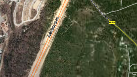
look, the relative accuracy (ie between a nearby point) is quite good. But the absolute precision (ie between long distance points) or the actual position is rather poor.
Sometimes there are horrors of up to thirty meters, so to have nothing, is good but for serious work that may have legal implications, such as being a plane to issue a title are not recommended.
This post have an example
a greeting.
I would like to know if the googl eart images uses a real scale ..!
if I can use them to compare a plane in AutoCAd…?
you would appreciate the information ..!
in excel with txt termination
Hello Marilin, what database format are you in?
Hello
I would like to know how I can import a database of utm coordinates to google earth I could not do it
Well, maybe if you are more specific we can help you as the field is broad.
There is a link about the author, in the links on the right where my email is ... and we are at your service if we can help you with something.
Hello, how would you like to know how I can implement a GPS system in the application? On the other hand, I imagine that there should be other tools for tempera tiling etc, etc. I need to know since I have that doubt or if someone can send me the information about the El Salvador temple processors or I do not know if I am wrong in what I want to know if you can give me an orientation Thanks Greetings
what you want to do, high resolution images and use of gps only obtained with paid versions (Google Earth plus), $ 20 annual
I would like to obtain in google earth the way of making approaches as it is appreciated in the free version, but of high resolution, to green areas urbanizations, roads, etc. in real time and that allows the use of GPS, which recommends me. Thank you
Hello Martin, the first thing is to understand that Google supports data with latitude / longitude coordinates (in decimal degrees), with the wgs84 spheroid. So the points you have should be brought to these conditions.
The first thing is to know in which projection are the data that you have, in the case of Fernando, had some data in cylindrical projection utm, zone 13, of itrf12, which is a projection of mexico with the datum grs80. Once you know in which projection they must reproject the one that supports googleearth (google earth does not reproject, they must be provided already changed).
If you have a fragment of the base (some 10 data) in excel send me to analyze it, in a following post I will try to explain how the reprojection is done.
Editor (at) geofumadas.com
I HAVE A DATABASE CORRESPONDING TO NICHES OR POINTS OF TERSER ORDER (GPS), WHICH YOU WANT TO IMPORT GOOGLE EARTH, FOR INTERNAL CONSULTATION, THE PROBLEM IS THAT I HAVE NOT BEABLE TO IMPORTS THEM WITH SUCCESS, AS I MAKE AN ERROR IN THE FORMAT , I WOULD LIKE TO KNOW WHAT WOULD BE THE BEST OPTION TO PERFORM THIS AMOUNT, THE VERSION OF THE GOOGLE USED CURRENTLY IS GOOGLE EARTH PRO.
GREETINGS AND THANKS.
I have a problem I could not import data with known coordinates can help me with the correct procedure I have the gogle earth pro