
Chronicle - FME World Tour Barcelona
We recently attended the FME World Tour 2019 event, led by Con Terra. The event was held in three locations in Spain (Bilbao, Barcelona and Madrid), showed the advances offered by FME software, its central theme was the Game of Transformation with FME.

With this tour, the representatives of Con Terra and FME, showed how their growth has been based on the requirements and requests of users for each of their products, such as the FME Desktop, FME Server, and FME Cloud. Additionally, State and private institutions were presented who showed their success stories, maintaining alliances with Con-Terra and the constant use of FME.
Development of the Day
The session began with a game to break the ice with the attendees, using the mobile phone, a series of questions related to the FME transformers were answered, and prizes were awarded to those who responded correctly and quickly. Then, the demonstrations of the interface updates began.
We did this event in Bilbao, Barcelona and now we are going to Madrid, we have been impressed with the number of people that have come to participate in the event, since generally those who come are users who want to learn about the news that FME brings and how to apply it in your projects We are very happy with the receptivity we have had. " Laura Giuffrida - With terra GmbH
It seems very curious that a software that can perform processes that alleviate the load of the multiple tools that contains a GIS application, is not yet so recognized - especially in South America - where the number of users is practically nil, compared to several countries from Europe and North America (United States or Canada). FME Desktop Software, is well known for having a simple interface and tools that provide a great user experience.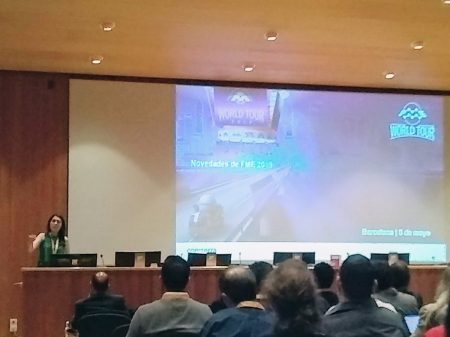
To give an idea of what is going on, we start by saying that it supports and processes multiple types of data formats, from a shape (.shp), CAD (.dxf, .dwg), non-spatial formats such as databases, or modeling data. 3D as BIM. So, what makes FME, can clean all kinds of errors or circumstances that when entering them in a GIS can create severe problems. One of the most obvious examples - and we know that many GIS analysts have gone through this - are the topology errors, FME cleans all that kind of errors so that when entering them in ArcGIS or another GIS, the PC does not collapse with the alerts.
In addition to cleaning, FME can transform the nature of the data, as well as each of the elements that are contained in each file-rename, add, remove attributes, fields. The above is possible, with the use of more than 450 transformers, designed for each specific need, which can be compared with other users through the FME Hub., New components such as packages and projects were also discussed.
The exhibitors emphasized the addition of a series of tools and functionalities, for example, transformers associated with raster processing were added to the software, such as: RasterObjectDetector, RasterObjectDetectorTrainer, and the NaturalLanguageProcessor, and also new transformers focused on Machine learning.
The advantage of FME is that it supports the entry and management of multiple types of data, and with this you can solve all kinds of circumstances associated with them. Laura Giuffrida - With terra GmbH
For the old and current users of FME, for sure remember that the software had built-in decompression function, however, in this new version you can add the compressed data and the system will read them, without needing to extract them previously on the desktop, something very useful, since not all applications and softwares accept compressed files, which translates into saving time in the completion of tasks.
FME is not a data visualization tool, it is a software that is in the backstage of the GIS or other systems, its strength lies in the processing, data cleaning through the use of transformers. Finally, after doing what is required, you rewrite it in the format you need. Laura Giuffrida - With terra GmbH

Most of the attendees to events related to FME, are those who have time using FME software as a spearhead for their projects (companies or governments), both locally and nationally. This year, the assistance has been a little wider, it was evident that there were people in the room who have never used the application and attended to know its benefits, a plus for Con Terra and FME.
To catch the attendees, it began indicating all the updates of their tools and the incorporation of new ones. It started with the interface, it is possible to change to dark mode, one of the requirements made by users, also improvements in annotations, colors according to the data, windows that can be arranged to suit the user.
The formats were also discussed: DICOM (images of machines that are in the human body), TopoJSON (with topological relationships), WCS, extraction and reading of GPS devices (Garmin POI), access to the Socrates API and new connectors that will be part of the FME Hub, such as: AzureBlobStorageConnector, S3Connector, or CityworksConnector.
FME reads and writes the ESRI i3s files
Also, a raster-related functionality is added to multitemporal studies, where the images are placed - dragging them from their source folder - and the system performs a scan presenting the variations, generating at the end an animation with all the selected images. Another very accurate update is the one related to ChangeDetector -formerly UpdateDetector-, used to determine changes between one data collection and another, it is now possible to determine the data tolerance margins. In addition, the possibility of creating default values was added so that the user, who requires a transformer multiple times, does not have to perform the whole process from the beginning, placing the parameters at each moment.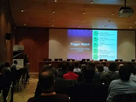
The novelties were not only related to the FME Desktop, but also to other elements such as the FME Server, in which elements such as: project record filtering, token management, transfer of FME Server projects in the FME Hub, addition were added of password security rules, and user configuration preferences.
In addition, there was talk of improving one of the most anticipated tools, the EsriReprojector, which previously the user required to have the ESRI-ArcGIS license, now in this update does not use ArcObjects or requires a license other than the FME.
If we talk about the success stories presented, there were several institutions that congregated to show the advantages of the use of FME, with projects such as Publication and dissemination of the Municipal Topographic Cartography of the City of Barcelona of the Institut Municipal d'Informàtica Ajuntament de Barcelona, Nexus Geographics was also present indicating how they implemented dynamic download services and automation of metadata management in the IDE with the use of FME Server .
License?
We are sure that they ask, if FME requires the purchase of a license, well, however, some analysts and users have stressed that acquiring it does not represent a great expense, but a long-term investment, for all the advantages that represents for the generation of projects of all kinds and in all types of areas. For more information about Safe Software products, FME developers, you should only go to their website, or blog where the community expresses its concerns, responds to how the processes are carried out, and the description of all the transformers and tools.


