How to connect GvSIG with Manifold GIS
I have data within a manifold geodatabase, with a .map extension and I want GvSIG users to access them.
Let's look at two different ways of doing this:
1. Through Web Feature Services (WFS)
This is done by creating wfs services with Manifold, and although I explained A couple of months ago, is summarized in:
/ Export / html file and setting it to create OGC wfs services
So to connect GvSIG to these you only do
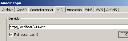
Add layer / wfs /
and write on the panel the address of the service, which can be on the intranet, in the case of being my own machine I choose: http: //localhost/wfs.asp
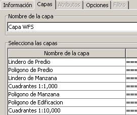 Once the connect button is pressed, if the system finds the data, the "next" button is activated or the available tab is chosen.
The "layers" tab shows what type of components are available
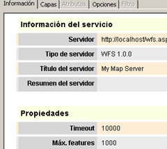
The "information" tab shows the characteristics of the service such as the server, ogc version of the service, type of server, waiting time and maximum attributes that can be downloaded.
These last options are configured in the "options" tab, the more attributes are chosen, the timeout must also be raised.
 In case of not allocating enough, the data download will be limited to this amount; but also the cooling rate will be better.
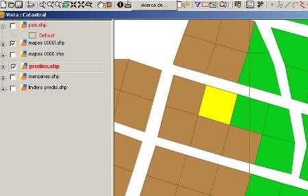
I have chosen 1000 as a maximum of features and immediately the layers on the left are created directly from the Manifold map.
2. Through Web Map Services (WMS)
This is done by creating services Same services with Manifold, but indicating that you also create wms services:
/ Export / html file and defining it to create OGC wms services
Right there, the cooling time is defined.
In order to connect GvSIG to these, the same previous process is done but the wms tab.
and write on the panel the address of the service, which can be on the intranet or internet, in the case of being my own machine I choose: http: //localhost/wms.asp
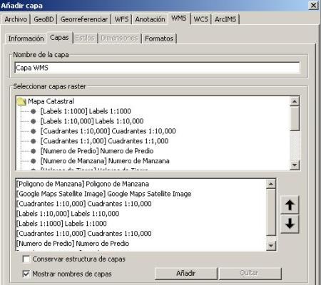
The difference is that this service only shows the data as images but always themed according to the configuration of the Manifold map component.