Cadastre
Resources and applications for the administrative registry in which the rustic, urban and special properties are described.
-

IMARA.EARTH the startup that quantifies environmental impact
For the 6th edition of Twingeo Magazine, we had the opportunity to interview Elise Van Tilborg, Co-founder of IMARA.Earth. This Dutch startup recently won the Planet Challenge at Copernicus Masters 2020 and is committed to a more sustainable world through…
Read More » -

Master in Legal Geometries.
What to expect from the Master in Legal Geometries. Throughout history, it has been determined that the real estate cadastre is the most effective tool for land management, thanks to which thousands of data are obtained…
Read More » -

Vexel launches UltraCam Osprey 4.1
UltraCam Osprey 4.1 Vexcel Imaging announces the release of the next generation of UltraCam Osprey 4.1, a highly versatile large-format aerial camera for the simultaneous collection of photogrammetric-grade nadir images (PAN, RGB, and NIR) and…
Read More » -

AulaGEO, the best course offer for Geo-engineering professionals
AulaGEO is a training proposal, based on the Geo-engineering spectrum, with modular blocks in the Geospatial, Engineering and Operations sequence. The methodological design is based on "Expert Courses", focused on competencies; It means they focus on…
Read More » -

ArcGIS Pro course - basic
Learn ArcGIS Pro Easy – is a course designed for geographic information system enthusiasts who want to learn how to use this Esri software, or users of previous versions who hope to update their knowledge of…
Read More » -

The role of geotechnologies in the conformation of a 3D Cadastre
On Thursday, November 29, as Geofumadas together with 297 attendees, we participated in a webinar promoted by UNIGIS under the theme: "The role of geotechnologies in the creation of a 3D Cadastre" by Diego Erba,…
Read More » -

IV Annual Conference of the Inter-American Network of Cadastre and Land Registry
Colombia, with the support of the Organization of American States (OAS) and the World Bank, will host the "IV Annual Conference of the Inter-American Network of Cadastre and Property Registry" to be held...
Read More » -

The importance of reducing intermediaries in the management Registry - Cadastre
In my recent presentation at the Seminar on Advances in Multipurpose Cadastre in Latin America, held in Bogotá, I focused on emphasizing the importance of placing the citizen at the center of the benefits of modernization processes. He mentioned…
Read More » -

Evolution of the Multi-Land Cadastre for sustainable development in Latin America
This is the title of the Seminar that will take place in Bogotá, Colombia from November 2 to 26, 2018, organized by the Colombian Association of Cadastral Engineers and Geodesists ACICG. Interesting proposal, in which…
Read More » -

How much is the land worth in your city?
A very broad question that can trigger multiple answers, many of them even emotional; many variables whether it is land with or without buildings, utilities or typical area lot. That there was a page where we could know...
Read More » -

Ten main reasons for making territorial data known
In an interesting article by Cadasta, Noel tells us that while more than 1,000 world leaders in land rights met in Washington DC in the middle of last year for the World Bank's Annual Land and Poverty Conference,…
Read More » -

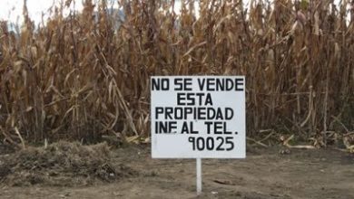
This land is NOT for sale
This is an interesting article by Frank Pichel, in which he analyzes the added value of legal certainty applied to real estate. The initial question is interesting and very true; It reminds me of my recent visit to the living zone…
Read More » -

My experience using Google Earth for Cadastre
I frequently see the same questions in the keywords by which users arrive at Geofumadas from the Google search engine. Can I make a cadastre using Google Earth? How accurate are Google Earth images? Because my…
Read More » -

Draw coordinates in AutoCAD from an Excel CSV file
I have gone to the field, and I have raised a total of 11 points of a property, as shown in the drawing. 7 of those points are the boundaries of the vacant lot, and four are the corners of the raised house.…
Read More » -

III Annual Conference of the Inter-American Cadastre and Land Registry Network
Uruguay, through the National Directorate of Cadastre and the General Directorate of Registries, will host the "III Annual Conference of the Inter-American Network of Cadastre and Property Registry" to be held in…
Read More » -

Accurate purpose-dependent cadastre - trend, synergy, technique, or nonsense?
Back in 2009 I elaborated the systematization of the evolution of the Cadastre of a municipality, which in its natural logic suggested a progress between the reasons why it originally adopts the cadastre for tax purposes, and how that…
Read More » -

QGIS, PostGIS, LADM - in the Land Administration Course developed by IGAC
In the convergence of different initiatives, aspirations and challenges that Colombia is experiencing to maintain leadership in the southern cone in geospatial matters, between July 27 and August 4, the Information Research and Development Center…
Read More » -

How to compare changes to a CAD file
A very frequent need is to be able to know the changes that have happened to a map or plan, compared to how it was before being edited or based on time, in CAD files such as DXF, DGN and DWG. The DGN file...
Read More »

