
Territorial Planning
Territorial Ordering. Territorial Planning Plan
-

How much is the land worth in your city?
A very broad question that can trigger multiple answers, many of them even emotional; many variables whether it is land with or without buildings, utilities or typical area lot. That there was a page where we could know...
Read More » -

The SINAP National System of Property Administration
The National Property Administration System (SINAP) is a technological platform that integrates all the information related to the physical and regulatory resources of the nation, where the different public, private and individual actors record all the transactions…
Read More » -

Recommendations when implementing LADM
In several of the projects that I have participated in, I have witnessed that the confusion caused by LADM is not necessarily associated with understanding it as an ISO standard, but rather with isolating its conceptual scope of application from its mechanization scenario...
Read More » -

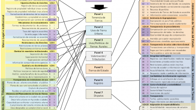
Land Administration Domain Model - Case of Colombia
The administration of the Earth is currently one of the main challenges of the countries. It is not a new aspiration, since its function is more than explicit in the main articles of the constitution and the different laws that govern...
Read More » -

Soil Values Mapping Project in Latin America and the Caribbean
The Lincoln Institute of Land Policies invites volunteers from all the cities of Latin America and the Caribbean to participate in the construction of a Map of Land Values for the region. This activity will take place…
Read More » -

Master in Urban Design and Planning [UJCV]
This is one of the most interesting master's degrees in the Central American region, considering the importance it has for local governments and the irreversible urgency of the disciplines implicit in the management of the territory under a development approach...
Read More » -

The delimitation of real estate property and interaction with public institutions
This is the topic that will be addressed at the II Conference of the Expert Geometer, which will be held on October 23, 2015 in Madrid. Several laws of great impact have recently been approved for real estate. This…
Read More » -

20 Steps to build a city from scratch
This is a collector's item for lovers of Urban Development and Territorial Planning, which beyond smoking in smart cities, which seems like a cliché pointing to the taste for complicating things, proposes in 20 simplified steps,…
Read More » -

Territorial Ordering Explained
Territorial Planning is a tool for the sustainable use of natural resources. For many years the Peruvian territory has been occupied under the logic of making the most of natural resources, causing in some…
Read More » -

What a geomatician should know about the LADM land management standard
The standard for land administration (Land Administration Domain Model) is known as LADM, which managed to become ISO 19152 since 2012. It is not a software, but a conceptual model that outlines the relationship between…
Read More » -
Land Governance: the LGAF methodology
It is known as LGAF, the methodology that in Spanish is known as the Land Governance Assessment Framework. This is an instrument with which the diagnosis of the legal status of a country is carried out, in…
Read More » -

Global Mapper course and 3 more offered by Civile
Civile is a company that offers various consulting and training services in alliance with other organizations in the sector, on issues such as the development of engineering projects, land use planning and the environment. In this case we highlight at least 4…
Read More » -

The Master in Territorial Planning of the UNAH
The Master's Degree in Territorial Planning and Management offered by the National Autonomous University of Honduras (UNAH), is an academic program that since its creation in 2005, has been developing jointly with the Department of Geography of the…
Read More » -

Latin American Forum on Notable Instruments of Urban Intervention
The Program for Latin America and the Caribbean of the Lincoln Institute of Land Policy announces this important forum, which will take place in Quito, Ecuador from May 5 to 10, 2013. Organized in conjunction with…
Read More » -

International Virtual Cadastre Symposium
With the co-sponsorship of the Association of Geographers of Peru and UNIGIS, Geowebss presents the symposium "Current situation of the cadastre and strategies for computer and telematic renewal", which will take place on Friday 10 and Saturday 11 August...
Read More » -

The strategic value of territorial information
Within the framework of the presentation of the Geological Map of the Canary Islands, the Technical Conference on The Strategic Value of Territorial Information will be held. The fundamental axis of the same will focus on geographic information, which as…
Read More » -

The Trans 450, Rapid Transit Bus for Tegucigalpa
This is an interesting project that is now being developed in Honduras, under the Rapid Transit Bus (BTR) modality. Although now it is in that stage of understanding before the carriers who do not have the clarity of how they evolve...
Read More » -

The topics of the Congress of Guatemala Surveying
Just after the Congress of Land Administration and Surveying held in Guatemala, the previous month, the presentations of the exhibitors have been posted. They are available on a single page, although it is more practical to see them on Slideshare, from where…
Read More »