GPS on Android, SuperSurv is a great alternative GIS
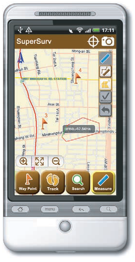
 SuperSurv is a tool developed especially for GPS in Android, as an application that integrates the GIS functionalities with which you can capture data in the field efficiently and economically.
GPS on Android
The recent version, SuperSurv 3 turns the mobile into a collector, with geolocation, map deployment, query, measurement and route tracking.
It is interesting that the data can be saved in shape file (SHP) format and in GEO, which is a proprietary format of Supergeo; we talked about a few days ago. With the GPS functions you can save routes.
What you can do with SuperSurv 3
- Collect data quickly in point, line and polygon formats
- Display spatial data in global coordinate system
- Create and manage routes
- Access data from SuperGIS Server
- Consult and measure maps using GIS tools
- View locations and directions in real time
- Use maps offline, in shp, GEO formats and information cached in a file of extension sgt
- Use Augmented Reality to Display Route Positions
- Take advantage of GPS features on Android
Uses of SuperSurv 3
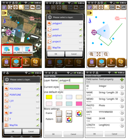
Field technicians, both for cadastre purposes and environmental studies, can take advantage of the capture of information through GPS or draw freehand on the screen. They can be switched off, on, and layer selection to choose where the data will be stored. To facilitate data collection, it is interesting that each layer can have a table with attributes that can be adapted to text, numeric, date, time, coordinate, etc… formats and without much turning.
Supports global coordinates in geographic format. The E-compass property allows you to locate the bearing on the map; so that users can see the current properties in the status bar and track the route they have traveled.
Additionally, the mobile camera function, be it a smartphone or a tablet, can be stored in a geo-referenced way.
The data display is not only in vector and raster formats, but also to services via web map services. Switching between the data of one service and others ... is quite advanced in terms of functionality and practicality.

And finally, for easy manipulation, it is interesting that when creating a new project it uses the characteristics of the last one used to continue in the same environment without having to configure everything again. Another striking feature of practicality is the handling of layers, which can be superimposed in different order, with the option of transparency that ensures that you can see more than one layer at the same time.
In short, the best for GPS in Android.
How much is SuperSurv worth?
Usually walks in 200 dollars the license, for the Spanish-speaking market ZatocaConnect can offer it with special discounts.
Further information:
Supergeo
Request a quote with a special price


There is the gis software download link
I find it very interesnate, but I could not download it from the supergeo site. Is in another place ????
regards
SBR
please post very interesting send me more information
regards
fabian yanez