
November was gone, summary of the month
This month was less productive than the previous ones, when I had been on the 40 post, in this case I was because of the 28 product that the trips have been complicated and the need to finish some pending issues.
Free GIS Software
 Although this theme is recent in my blog, the experience I am getting with the training and implementation of gvSIG is leaving me a clear picture of the feasibility of being able to spread it in government institutions that have lived half of their lives pirating commercial software.
Private Software
 Few novelties have brought commercial tools, just the launch of Microstation V8i from which a lot of noise has been heard but few results from users. Still I'm sure this version will mark an outstanding milestone in Bentley's technology that is apparently betting it seriously with a redesign of this level.
Battling with Manifold GIS
 What to say, this has been the middle of my month, trying to write the last chapter of the Manifold GIS manual, through trial and error I have been struggling with the map publishing capabilities of this tool. Although learning is painful, I must admit that to have this low cost, it seemed like a good starting point for the next month when I plan to enter mapserver.
- A Manifold GIS course on 2 days
- Dynamic Maps, to do more with IMS Manifold
- More problems with Manifold IMS
- Publishing maps on the Internet with Manifold GIS
- Questions about IIS, IMS and Manifold GIS
- Manifold IMS, doing something else
Google Earth and other virtual worlds
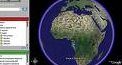 The achievement stands out, after many battles of wanting to make ContouringGE work, that it had stung me after several attempts and the partial conclusion that did not work.
- Google Street View arrives in Guadalajara
- How to upload a kml to Google Maps
- Now SPOT integrated into Google Earth
- Virtual Earth updates images of Spain
- Google ContouringGE, you can !!
Events
 Few, very few to get my attention.
Personal matters and part of my free time
 My daughter graduated for the first time at age six, defined CONCACAF and gave entrance to the exagonal, a friend wanting to win the Nokia ...
- Geofumadas, my artistic side
- Soccer, how things went in the Caribbean
- the other half of my life
- Who does not want to win the Nokia
Extra smoked
 In this I was pleased to smoke the possibility that Google was playing a bad joke for the drop in revenue in AdSense, and I do not know if they heard me (that arrogance, hehe) but it seems that now everything returns to normal and improves slightly.


