Maps

More old and strange maps

I recently told you about Rumsey's map collection, which you could see About Google Maps. Now Leszek Pawlowicz tells us about a new site dedicated to storing and selling historical map services, founded by Kevin James Brown in 1999.

Is Geographicus, which sells map services in printed formats, framed etc. They have an affiliate system and pay 10% commission per sale made from a referred site. You have to take a look as they have some rare map examples on the web.

Here is an example of how the Japanese saw us 130 years ago. It's a map of the Western Hemisphere from 1879.

Old maps

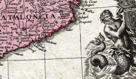
See this one from 1730, amazing how these guys used the ArcView.

Old maps

They also have a blog to keep up with news or curiosities on the maps. Here is the top list of top categories:

Maps & Directions

World Maps
United States
Americas
Europe
Africa
Asia
Middle East - Holy Land
Australia & Polynesia
Arctic & Antarctic
Miscellaneous

Maps by type:

Wall Maps
Pocket & Case Maps
Nautical Maps
City Plans
Celestial & Lunar Maps
Japanese Maps
Atlases

Golgi Alvarez

Writer, researcher, specialist in Land Management Models. He has participated in the conceptualization and implementation of models such as: National Property Administration System SINAP in Honduras, Management Model of Joint Municipalities in Honduras, Integrated Cadastre-Registry Management Model in Nicaragua, Territory Administration System SAT in Colombia . Editor of the Geofumadas knowledge blog since 2007 and creator of the AulaGEO Academy that includes more than 100 courses on GIS - CAD - BIM - Digital Twins topics.

Related Articles

Leave a comment

Your email address will not be published. Required fields are marked with *

Back to top button