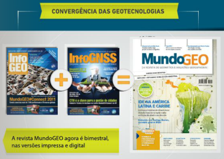
InfoGEO + InfoGNSS = MundoGEO
The first edition of MundoGEO magazine has been launched, which as we had known would be the integration of the two magazines promoted by this portal: InfoGEO / InfoGNSS.

The new format will be bimonthly, so we will have at least 6 copies a year. For now the edition in Portuguese has been made available, but there will also be in English and Spanish, which is expected to arrive from March. In addition to the digital format, the printed format will also be maintained, although the advertisers are not the same.
It seems an interesting step, MundoGEO will know why consolidate two magazines in one, without doubt will be the publication Most representative of the Hispanic sector in the area of Geo-Engineering. The fact that there is a Spanish version is an important milestone of internationalization and attraction of the eyes of companies to this area that has a lot of potential but where the take-off of some investments in this area is slower.
The article by Wilson Anderson Holler reminds us that the world is not over in 2012 and this change added to the launch of Geo Connect People we find valuable contributions from the brazilian community to the Pan American ecosystem.
we welcome you to the magazine and in passing we mention some issues that catch our attention:
- Who is who in geotechnologies.
- Interview with Santiabo Borrero Mutis, of the Pan American Institute of Geography and History.
- How the IDEs in Latin America are going.
- Application of GIS to Urban Transport.

See the magazine in MundoGEO
The magazine is uploaded on Calameo, a very good platform to publish magazines in digital format. From there it can be downloaded, in a high resolution version. Very good for downloading, although a disadvantage for browsing because being uploaded in heavy format, more than once the Flash plugin crashes when wanting to send a pdf where all the objects are in high resolution vector format.


