How to create hyperlinks in Manifold GIS
A hyperlink is always necessary on a map, we have used it, for example, in a cadastral layer to associate photographs, cadastral certificate, registry deed or in the case of the municipal layer to associate information related to that territory, mainly that which does not it is easily tabulated. We will see in this case how to create hyperlinks in a map using the program Manifold GIS.
1 The layer
Manifold handles files with a .map extension, which in themselves are equivalent to a personal geodatabase, where images, vector layers, tables, etc. can be stored. But there can also be only linked files just like an ArcGIS mxd would.
So to associate a hyperlink, the object must have a table; This can be outside the map (linked) or even in an external database of type Oracle, MySQL etc.
2 How to do it
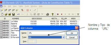
The first thing is to add a new column, it is assigned name and type, in this case we choose url.
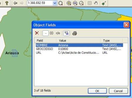
Then in this the address of the associated file is placed, this can be local, in one of the disks of the machine, in an intranet with IP or team name or even in Internet with a URL of type http: //
Manifold accepts addresses that have spaces, even in web url, it does the transformation of characters when calling the object.

3. The result
To open the hyperlink, just click on the map and it will lift the file in the respective program.

So that it does not raise the hyperlink as a primary object, it is clicked using the ctrl key, in this way it will raise the table of data associated with the object.
In case of sending the file to an IMS service, the hyperlink is maintained, this is one of the tricks used to work with multiple files in an IMS publication as we saw it does few days.