Guatemala and its challenge to find the role of the Academy in Territorial Management
The Science and Technology Division of the San Carlos University of Guatemala is a good example of the work that the academy must do to make the profession sustainable in the area of territorial management. This is hard work that usually progresses slowly, but after A review i did Three years ago, it is good to know the progress they have made: among other things, the first class of graduates and two regional conferences.
It is good to know the first thesis they have posted on the site: Analysis of urban growth and changes in land use during the 1960-2006 period, is also a basic proposal for territorial units in at least four municipalities conurbated with Quetzaltenango (Salcajá, Olintepeque, La Esperanza and San Mateo).
The academic offer is only available at the Western University Center (CUNOC) for now, but this is also good so that the initial influence of the capital does not take away the solidity that processes like this require in its early years. In addition, the confluence of municipalities in the region makes these careers contribute to the needs of this area in the agri-food chains, agribusiness, renewable natural resources, rural development, environmental management and land administration.
At least three careers are promoted by the Science and Technology Division:
- Agricultural Engineer in Agricultural Production Systems
- Engineer in Local Environmental Management
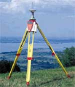
- Surveying Technician and Land Management Engineer

In the case of the third, and the one that has much to do with our subject, seeks to offer the student the opportunity to train academically to address the problems of the land from a technical, social, legal, and economic perspective and ensure the availability of specialized human resources, to assume the activities involved in the management of the territory and the design, execution and control of measurement projects, cadastres, territorial planning, land administration, management of spatial information and any other social development projects and economic of the nation.

The design of the curricular proposal is also due to a deep analysis of the work of the surveyor profession in different countries of the world, and the recent evolution that has transformed this profession due to technological advancement and economic globalization. This has priority in at least four areas:
|
Topography |
Discipline that provides the fundamental knowledge for the measurement, in the description of the terrestrial surface in a local scope for diverse applications like cadastral, agricultural and forestry surveys, densification of networks. |
|
Cadastre |
It gives the knowledge for the development of inventories of real estate considering the physical part and its legal conciliation for the planning of the proper development of the country and multiple purposes. |
|
Geodesy |
Science of the measurement and projection of the Earth and the determination of the position of objects on it and in the surrounding space as a function of time, as well as the study of its field of gravity. |
|
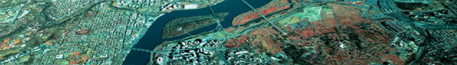
Photogrammetry and remote sensors |
Disciplinary area that provides the knowledge to obtain, process, and analyze spatial information of aerial or terrestrial metric photos, as well as the handling and processing of digital images. |
|
Geographic Information Systems and Cartography |
Disciplinary area that generates the knowledge to be able to graphically represent in analogous form and digital the surface of the Earth, besides to correlate numerical or literal information selected and ordered from a data bank, allowing the interdisciplinary work. |
|
Geomatics |
It provides the knowledge for the capture, storage, evaluation, updating, of large volumes of information related to objects of the terrestrial surface, referring to a coordinate system, with the application of computer tools that facilitate an agile and integrated management, Analysis and decision making. |
I had the opportunity to hear from the professors and promoters of this movement, the progress they have had, the way they are equipping the laboratories and some of their future perspectives. It seems like a great job to me, although with many challenges in creating conditions for labor reintegration and incidence in state policy; It was to be seen the uproar that RIC officials caused among the students when they excitedly told them that they were certifying technicians for Cadastre with a few hours of training and without prior training requirements.

The Dutch Cooperation through ITC and Nuffic has done a great job in this. At this point, about 30 teachers have already been trained, many of them at the master's level and the careers exist on a stable basis. The need to do a greater job of systematization and visibility of what has been achieved is visualized; to give examples: publish online a categorized mapping of actions of the university extension so that it is known where the practice projects of each class are, their scope and products; in this way continuity is maintained, the atomization of efforts is avoided and the information becomes more useful than a simple requirement.
The most significant effort in terms of international visibility is the Congress of Land Management, which is projected to achieve integrative work between state institutions, cooperation agencies and private companies every two years. Without fear of being wrong, I see Guatemala in a proactive role in the region, with a neutral convening power that moves the isthmus to unify efforts for what we really need and not necessarily driven by international projects that well-intentioned sometimes only seem to have an eagerness to allocate financial resources from the United States and Europe.
Also the new generation of graduates has a strong challenge to form a proactive union, which invades the business sector, professional services and the state quagmire. As long as the modernization of the state is not insisted on in the laws that provide the administrative career, every four years we will continue to see the same customs of political patronage, our best human resource will be isolated in private companies or will emigrate to better settings.

I hope in two years to have results consistent with my optimism.
Further information can be obtained from the Division of Science and Technology.
More CUNOC careers