
Georeference a GoogleEarth image
Previously he had spoken of upload an orthophoto to Google Earth if we knew its georeference.
Now let's try in reverse, if we have a view in GoogleEarth, how to download and georeferencing it.
The first thing is, that we know what is good and why not Google Earth, before We've alredy talk about that. Well, the first thing is to have the view unfolded, and what we want is to download that image and georeferencing it. You must deactivate the terrain option so that the three-dimensional display does not deform the view, you must also make sure that the compass is in the north and the vertical view.

1. Marking the area of interest
You must make a box with the polygon tool of Google Earth, in the corners of the space that you want to cut. Then you get close enough to get the UTM coordinates, placing the pointer over the corner, you have to keep in mind that the accuracy of GoogleEarth is around the thirty meters so do not bother with decimals.

Now we are going to trim the box, we must move away so that the texts and compass do not remain inside the box and we do printscreen with the keyboard and we copy it to paint.

At this level can be cut in paint, as doing it more accurately is a waste of time between whether the red line is inside or outside. I insist, the GoogleEarth prcision does not merit fighting for a few meters. Now we open it with Office Picture Manager (comes with Windws) to cut the edges more delicately with the crop option and dragging the ends, I do it here because I want to improve the contrast a bit.

This is the resulting image with contrast and brightness change.
2 Importing the box to Microstation
Now we are going to georeference it using Microstation V8, we copy the coordinates data in excel in order x, y, z and save it in .txt format for z zero use. This is to not enter the points with the keyin on foot.
 Now in Microstation if the xyz data import palette is not activated, activate it with tools / toolboxes and select it at the end. With this tool we import the points from the excel file and that's it, now we have to stretch the image.
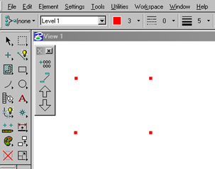 To make the points more visible you can change them color and thickness of point.
3 Georeferencing the image in Microstation

Now all that remains is to import the image, for this we use the raster manager command, with the “place interactive” option and place it within the four points.
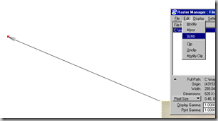 To stretch it we use the command warp, in option of four points and we indicate each corner of the image marking the points to which it corresponds.
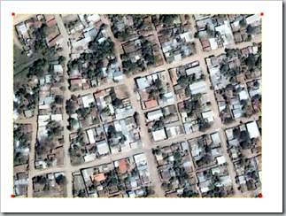 When we have indicated the four points we right click on the screen and go. The georeferenced googleearth image. Now from here this image can be saved in any georeferenced format.
4. Crushing on the pertinence of this
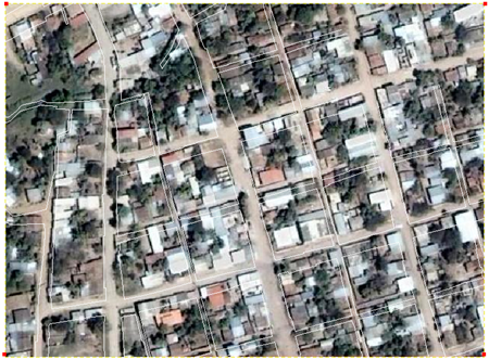
I insist as the last advice, this long procedure I have explained to spend a bit the time of this trip that already has me tired. Do not use this for serious work, because that does not serve GoogleEarth data. To show you an example, I superimposed the cadastral map.
Update, to download images in a less painful way can be done by connecting directly from Manifold system or with Google Maps Image Downloader


Yes, it is the same.
You only occupy known points.
Hi, GEO.
Tell me if to georeference in google an image is done the same to georeference a map sheet or UTM in microstations because I have many and I can not fit the GPS points in them. that I have to do? Thanks GEO for everything. BLESSINGS
your reports are always very good, I want you to help me I have a microstation and I have not been able to register it I think the software has a problem if you are so kind to send me this software I would like to thank you for everything we see you and keep cultivating that gift to teach see you soon
By fa if anyone can tell me how to georeferencio an image of google eart but in Idrisi Andes.
Hello Denis, what file format are you talking about?
how to load orthophoto with Microstation v8 when I load one tells me that the file is not compatible that will happen?
Hi Bea
the tool to make polygons comes in normal google earth, it is in the top bar.
If it is not visible, activate it using “view / Toolbar” and it is the third button
Hello,
I have a question regarding step 1, I cannot unfold the polygon to mark the box…. Do you use the GE PRO version or the normal version?
In advance thank you for your prompt response,
Regards!