
Difference between free Google Earth Pro and Google Earth images
There are many myths about it, from some that claim to see the neighbor tanning naked to those that do not find any difference between the versions. Let's see if we talk about the point with a couple of examples:
1. Yes, there is difference in resolution
What happens is that the difference in resolution is for output purposes, if you navigate through the images you will not notice the difference, but if you are going to save the display as jpg image or print a large coverage then you can notice it.
This is an example, of an apple, if I save the image to an elevation of 130 meters, see that There is no difference. The image on the right is from Google Earth Pro, the watermarks are because the version is trial; when opening the same box with the free version, for a strange reason it has a slight rotation. I guess it is one of the tricks that Google uses to mislead.

 Now see what happens if I move away to a height of 11.45 kilometers, when I save the image with the free version, the file measures only 800 × 800 pixels. When saving it with the Pro version, a tab is lifted to choose the resolution, up to 4,800 pixels.
At first sight the two images look the same, pay attention to the urban community indicated in the yellow arrow.

If I approach, it is clear that Yes, there is difference Of resolution, let's not say if I approached the level of the apple marked in the box.

And that is called output resolution, to save that image at that resolution with the free version they would have used a 7 x 7 mosaic, equivalent to 49 screenshots that would then have to be joined. Or course Use Stitch Maps With which they can be downloaded in mosaic.
The same applies when printing, imagine that you want to send the image of that urban community to the plotter, on photographic paper. It is literally impossible using the free version, the Pro version would do it very successfully.
2. The base of images is the same
The images between one version and another are the same, where there is no high resolution there is no. It does not matter what version of Google Earth you have.
3. What else does the $ 400 include?
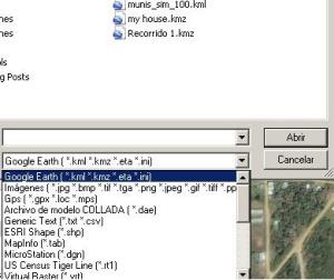 By purchasing a Google Earth Pro license you can open files such as:
- ESRI .shp
- .txt / .csv
- MapInfo .tab
- Microstation .dgn
- .gpx
- ERDAS .img
- ILWIS .mpr .mpl
- Among others…
Another important feature is that you can thematize maps based on criteria and apply templates.
Here you can Download Google Earth free version
Here you can download Google Earth Pro, trial for 7 days.


Ing. J ricardo parizaca go
Engineer geologist of the world
What happens is that Google shows UTM coordinates WGS84, the coordinates you mention can not be of this system but must have a different false and north, possibly a system adapted for your country.
To give you an example, the WGS84 Datum makes the false north Ecuador, starting the North at zero, so when it reaches the latitude of El Salvador, that coordinate already exceeds one million and a half meters. Also the false East is 500,000 in the zone 15, that is why in your country the coordinate X walks by the 200,000
I have configured in the tools tab. the option to see the coordinates in utm, for the region of central america, especially the salvador but the coordinates that it sends are not real, because that happens that example the coordinates that I should see in google would be X = 440845.16, y = 307853.82 correspond to a site in lake coatepeque which are seen by means of google are 224704.25m and 1537311.93m the two information belong to the same point, please can you designate me, thank you