
How to create a Custom Map and Do not Die in the Intent?
The company Allware ltd has recently launched a Web Framework called eZhing (Www.ezhing.com), with which you can in 4 steps have your own private map with indicators and IoT (Sensors, IBeacons, Alamas, etc.) all in real time.

1.- Create your Layout (Zones, Objects, Figures) layout -> Save,
2.- Name the property objects -> Save,
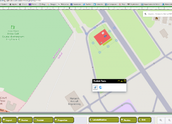
3.- Expose your creation in a Geographical Map publish -> Save -> preview,
4.- If you want to give life to your objects you can do it by REST with a simple curl.
ej : curl -d ‘{“labels”:[“2013″,”2014″],”series”:{“serie1″:[1.794,4.765],”serie2”:[0,0]}}’ “https://api.ezhing.com/1.0/data/graphChile?type=linechart&apikey=CLrDLosL4IB5hY0KdqnV1-WfOBQs7BHNUOk-Ne28JqI”
Ready!! You have already created your first active map without being GIS expert.

The eZhing Team friends (support@ezhing.com) will be available to help you at no cost.
Www.ezhing.com #Custom #Map #Gauge #IoT # Real-Time # Online #free


I want the autocad 2009 program to be installed
Hello dear participants of this blog. This is a tool with high potential for the solid development team of a company well known in the industrial sector. Allware.
Excellent Tool !!