AutoCAD-AutoDeskMapsCadastreAulaGEO coursesTeaching CAD / GISGeospatial - GISGoogle earth / mapsEngineeringMicrostation-BentleyQgis

AulaGEO, the best course offer for Geo-engineering professionals

AulaGEO is a training proposal, based on the Geo-engineering spectrum, with modular blocks in the Geospatial, Engineering and Operations sequence. The methodological design is based on "Expert Courses", focused on competencies; it means that they focus on practice, doing the tasks on practical cases, preferably a single project context and with theoretical support that strengthens what is being practiced.

The characteristics of the AulaGEO methodology courses include:

  • 100% online.
  • Lifetime access to course content. It means that they can be taken at the student's pace, and accessed as many times as required forever.
  • Accessible from mobile devices.
  • Audio explained step by step, such as a custom class.
  • Materials for download, to implement the courses.
  • Developed by professionals experienced in their subjects.
  • 30 guarantee if you are not satisfied with the course purchased.
  • Totally accessible prices.
  • Available in English, some of them with subtitles in more than 15 languages.
  • Also available in Spanish language.

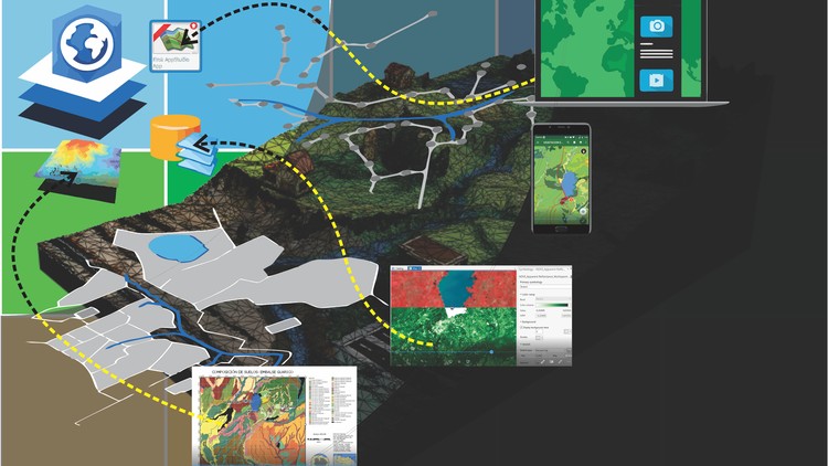
The conceptual development of AulaGEO that best explains the scope can be visualized in the graph, which is developed in packages as follows:

Expert in Geospatial Modeling.

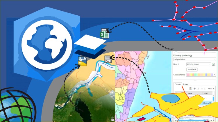
This includes training in Geographic Information Systems, using both the most exclusive proprietary software (ArcGIS) and the free QGIS software; at its advanced levels it includes mobile application development using html5 and the Google Maps API.

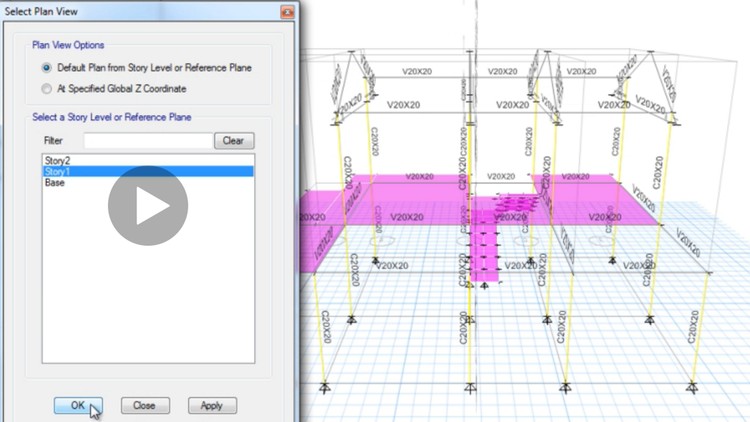
  1. Geographic Information Systems with ArcGIS 10
  2. Learn ArcGIS Pro Easy
  3. Learn advanced ArcGIS Pro
  4. Easy QGIS
  5. QGIS step by step
  6. QGIS + ArcGIS Pro parallel method in the same course
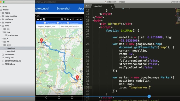
  7. Geolocation using HML5 and Google Maps
  8. Web GIS and ArcPy

The courses can be taken individually, according to the need and experience that you already have, or as reinforcement to prior knowledge.


Remote Sensing Expert

  1. Introduction to Remote Sensors
  2. Flood modeling with HecRAS from scratch
  3. Analysis and modeling of floods with ArcGIS HecRAS and GeoRAS
  4. Google Earth course

The courses in this module are an advanced level that users with experience in GIS applications could take, but they are also an interesting transition between geospatial and civil works design. That is why the Remote Sensing and Hec-RAS courses include reviews using ArcGIS and QGIS, and as a general leveling the Google Earth course is included.


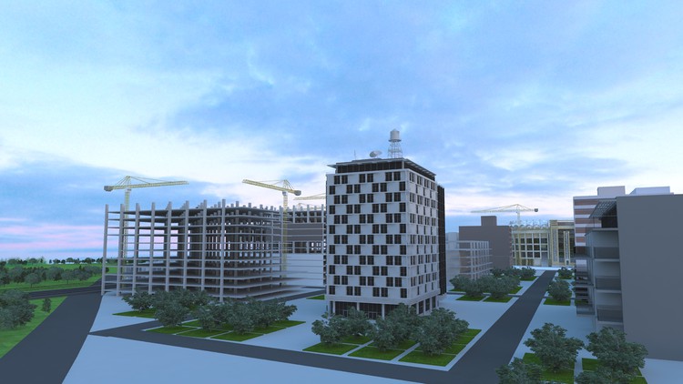
Civil Works Design Expert

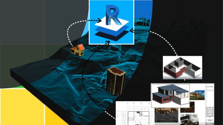
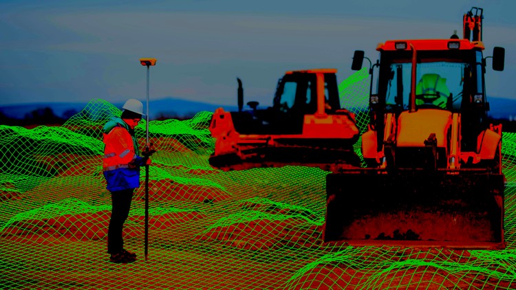
  1. Digital terrain models.  This course includes the explanation of photogrammetric methods to work digital models and point clouds using images, such as happens with aerial photography taken by airplanes or drones. In the course, AutoDesk Recap, Regard3D, MeshLab, SketchFab and Bentley ContextCapture are used for similar or complementary tasks. Includes creating surfaces using point clouds with Civil3D.
  2. Civil 3D Level 1.  This first level includes the management of Points, creation of surfaces and alignments.
  3. Civil 3D Level 2.  This works assemblies, surfaces, cross sections and volume cubing.
  4. Civil 3D Level 3.  Here you can see alignments in more advanced levels, as well as with surfaces and cross sections.
  5. Civil 3D Level 4.  Work with esplanades, sanitary drains, plots and intersections in linear works.
  6. CAD Tricks - GIS with Excel advanced and macros.

BIM Expert in Electromechanical Engineering
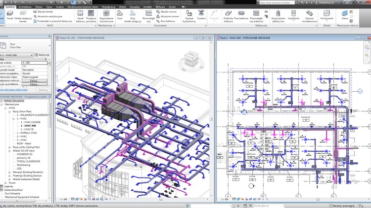
  1. Revit MEPHere we explain the installation of different elements of infrastructure design, related to electrical, mechanical and plumbing systems.
  2. Hydrosanitary Systems.  This course is explanatory step by step on the three-dimensional construction of all the elements of a hydrosanitary environment of a building, its connections and generation of final plans.
  3. Revit MEP for electrical systems.
  4. Revit MEP for electromechanical systems. Coming Soon.
  5. Revit MEP for plumbing systems. Coming Soon.


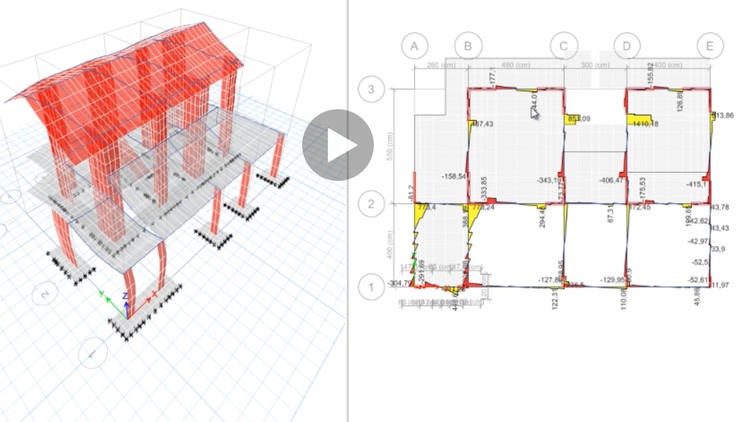
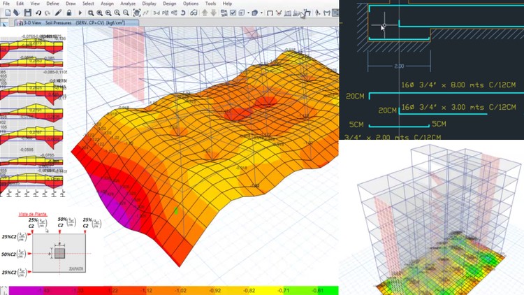
BIM Expert in Structural Engineering

This module includes the structural design using two software lines: AutoDesk Revit and CSI ETABS.

  1. Structural design using Revit Structure
  2. Steel design, using Advanced Steel
  3. Advanced Analysis with Structural Robot
  4. Structural projects with AutoDesk.

In the case of ETABS, the offer is:

  1. Design of earthquake-resistant buildings with ETABS, level 1.
  2. Design of earthquake-resistant buildings with ETABS, level 2.
  3. Specialization in structural design with CSI and ETABS.
  4. Structural masonry with ETABS. Coming Soon.

BIM Architectural Design Expert

  1. Learn Revit Easy
  2. BIM Fundamentals in Architectural Design with Revit


BIM Project Expert

  1. Complete course of the BIM methodology. This is a course that covers the theoretical and practical concepts for the management of the BIM methodology, including the 4D and 5D aspects applied to Budgets and simulations of the construction process.
  2. BIM 4D using Navisworks. Soon.
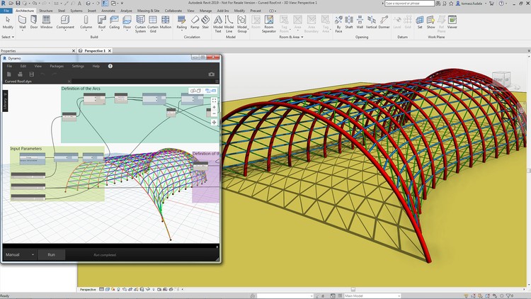


View more
sketchup

Course - Sketchup Modeling

Sketchup Modeling AulaGEO presents the 3D modeling course with Sketchup, it is a tool to conceptualize all architectural forms ...
See more...
View more
22

Structural Masonry Course with ETABS - Module 2

AulaGEO presents this course to elaborate a real housing project with Structural Masonry Walls, using the most ...
See more...
View more
21

Structural Masonry Course with ETABS - Module 3

With this course you will be able to elaborate a real house project with Structural Masonry Walls, using the most powerful tool ...
See more...
View more
19

Structural Masonry Course with ETABS - Module 5

With this course you will be able to develop a real house project with Structural Masonry Walls, using the most powerful tool ...
See more...
View more
2703050_5f37_2

ArcGIS Pro course - zero to advanced and ArcPy

Do you want to learn how to use the tools provided by ArcGIS Pro, starting from scratch? This course includes the basics of ...
See more...
View more
bim

BIM Course - The Methodology to coordinate construction

The BIM concept was born as a methodology for the standardization of data and the operation of the processes of ...
See more...
View more
science

Data Science Course - Learn with Python, Plotly and Leaflet

Currently there are many interested in the treatment of large amounts of data to interpret or make correct decisions in all ...
See more...
View more
bim methodology

Complete course of the BIM methodology

In this advanced course I show you step by step how to implement the BIM methodology in projects and organizations. Including modules ...
See more...
View more
16

CSI ETABS Course - Structural Design - Specialization Course

This is a course consisting of advanced theoretical and practical development of Structural Masonry Walls. It will be explained in ...
See more...
View more
23

Structural Masonry Course with ETABS - Module 1

This course consists of the advanced theoretical and practical development of Structural Masonry Walls. Everything related to ...
See more...
View more
20

Structural Masonry Course with ETABS - Module 4

In this course you will be able to develop a real house project with Structural Masonry Walls, using the most powerful tool ...
See more...
View more
18

Structural Masonry Course with ETABS - Module 6

With this course you will be able to prepare a real house project with structural masonry walls, using the most powerful tool ...
See more...
View more
17

Structural Masonry Course with ETABS - Module 7

In this AulaGEO course, it shows how to prepare a real house project with structural masonry walls, using ...
See more...
View more
years

Ansys Workbench 2020 Course

Ansys Workbench 2020 R1 Once again AulaGEO brings a new offer for training in Ansys Workbench 2020 R1 ...
See more...
View more
1927556_8ac8_3

ArcGIS Pro course - basic

Learn ArcGIS Pro Easy - it is a course designed for enthusiasts of geographic information systems, who want ...
See more...
View more
advanced arcgis course

Advanced ArcGIS Pro Course

Learn to use advanced features of ArcGIS Pro - GIS software that replaces ArcMap Learn an advanced level of ...
See more...
View more
arcgis and qgis course

ArcGIS Pro and QGIS 3 course - about the same tasks

Learn GIS using both programs, with the same data model Warning The QGIS course was originally created in Spanish, ...
See more...
View more
Autocad

AutoCAD course - learn easy

This is a course designed to learn AutoCAD from scratch. AutoCAD is the most popular software for assisted design ...
See more...
View more
3DS

Autodesk 3ds Max Course

Learn Autodesk 3ds Max Autodesk 3ds Max, is a very complete software that offers all the possible tools to create ...
See more...
View more
revit course

Autodesk Revit course - easy

As easy as seeing an expert develop a home - explained step by step Learn AutoDesk Revit in an easy way ....
See more...
View more
naviworks

BIM 4D course - using Navisworks

We welcome you to the Naviworks environment, Autodesk's collaborative work tool, designed for project management ...
See more...
View more
blender

Blender course - City and landscape modeling

Blender 3D With this course, students will learn to use all the tools to model objects in 3D, through ...
See more...
View more
cd3d

Civil 3D course - Specialization in civil works

AulaGEO presents this set of 4 courses called "Autocad Civil3D for Topography and Civil Works" that will allow you to learn to...
See more...
View more
civil 3D level 1

Civil 3D course for civil works - Level 1

Points, surfaces and alignments. Learn to create designs and basic linear works with Autocad Civil3D software applied to Topography ...
See more...
View more
civil 3D level 2

Civil 3D course for civil works - Level 2

Assemblies, surfaces, cross sections, cubing. Learn to create designs and basic linear works with Autocad Civil3D software applied to ...
See more...
View more
civil 3D level 3

Civil 3D course for civil works - Level 3

Advanced alignments, surfaces, cross sections. Learn to create designs and basic linear works with Autocad Civil3D software applied to ...
See more...
View more
civil 3D level 4

Civil 3D course for civil works - Level 4

Grades, sanitary drains, parcels, intersections. Learn to create designs and basic linear works with Autocad Civil3D software applied to ...
See more...
View more
Robot structure course

Structural Design Course using AutoDesk Robot Structure

Complete guide to the use of Robot Structural Analysis for the modeling, calculation and design of concrete and steel structures ...
See more...
View more
bim dynamo course

Dynamo course for BIM engineering projects

BIM Computing Design This course is a friendly and introductory guide to the world of computational design using Dynamo, a platform ...
See more...
View more
Specialization course in structures with etabs

Specialization course in Structural Engineering with ETABS

Basic concepts of concrete buildings, using ETABS The objective of the course is to provide the participant with the basic tools ...
See more...
View more
2453960_32fc_3

ETABS Course for Structural Engineering - Level 1

Analysis and design of buildings - Zero level at advanced level. The objective of the course is to provide the participant with ...
See more...
View more
2453934_9f15_2 (1)

ETABS Course for Structural Engineering - Level 2

Analysis and design of earthquake-resistant buildings: with the CSI ETABS software The objective of the course is to provide ...
See more...
View more
revit architecture

Fundamentals of Architecture course using Revit

Everything you need to know about Revit for creating projects for buildings In this course we will focus on giving you ...
See more...
View more
geolocation with google maps html

Geolocation course for Android - using html5 and Google Maps

Learn how to implement google maps in your mobile applications with phonegap and the google javascript API In this ...
See more...
View more
4145820_ea33_3

Structural Geology Course

AulaGEO is a proposal that has been built over the years, offering a wide range of courses ...
See more...
View more
google earth course

Google Earth course - from scratch

Become a true Google Earth Pro expert and take advantage of the fact that this program is now free. For individuals, professionals, teachers, ...
See more...
View more
gearth

Google Earth course: from basic to advanced

Google Earth is a software that came to revolutionize the way we see the world. The experience of surrounding ...
See more...
View more
revit structure course

Structural Engineering Course using Revit

  Practical design guide with Building Information Model aimed at structural design. Draw, design and document your ...
See more...
View more
introductory course to programming

Introduction to programming course

  Learn to program, fundamentals of programming, flowcharts and pseudocodes, programming from scratch Requirements: Desires to learn Know ...
See more...
View more
remote sensing

Introduction to Remote Sensing Course

Discover the power of remote sensing. Experience, feel, analyze and see what you can do without being there. The...
See more...
View more
ansys workbench design

Introduction to design course using Ansys workbench

Basic guide to create mechanical simulations within this great finite element analysis program. More and more engineers ...
See more...
View more
cad

Microstation Course - Learn CAD Design

Microstation - Learn CAD Design If you want to learn how to use Microstation for CAD data management this course is ...
See more...
View more
MICROSTRAN

Microstran course: structural design

AulaGEO, brings you this new course focused on the design of structural elements, using Bentley's Microstran software ...
See more...
View more
Hecras course

Flood Modeling Course - HEC-RAS from scratch

Avenues and flood analysis with free software: HEC-RAS HEC-RAS is a program of the Army Corps of Engineers ...
See more...
View more
recap modeling

Reality Modeling Course - AutoDesk Recap and Regard3D

Create digital models from images, with free software and with Recap In this course you will learn to create e ...
See more...
View more
hecras and arcgis course

Flood modeling and analysis course - using HEC-RAS and ArcGIS

Discover the potentialities of Hec-RAS and Hec-GeoRAS for channel modeling and flood analysis #hecras This practical course ...
See more...
View more
structural project course

Structural projects course (Revit Structure + Robot + Reinforced concrete and Advanced Steel)

Learn to use Revit, Robot Structural Analysis and Advance Steel for structural design of buildings. Draw, design and document ...
See more...
View more
use python

Python Course - Learn to Program

AulaGEO brings everyone is an introductory Python course that will allow students to search for material and access ...
See more...
View more
bim plumbing

Revit MEP Course - Plumbing Installations

Creation of BIM models for pipeline installations What you will learn Work collaboratively on multi-disciplinary projects that involve ...
See more...
View more
revit hvac

Revit MEP Course - HVAC Mechanical Installations

In this course we will focus on the use of Revit tools that assist us in performing ...
See more...

Workflow Expert

These courses are aimed at those preparing for higher levels in design, in view of the inevitability of knowing some code to create ETLS in iterative engineering flows. Hence the selection of a course on leveling programming logic with pseudocodes, Ansys which is the relationship of finite elements with geometric design and Dynamo applied to BIM projects.

  1. Introduction to Programming
  2. Design with Ansys Workbench
  3. Dynamo analysis
  4. Design and mechanical simulation using Nastran. Coming Soon.
  5. Mechanical design with CREO. Coming Soon.
  6. Design and simulation using MatLab. Coming Soon.

In short, AulaGEO is a new and innovative training alternative, specialized courses oriented to the spectrum of Geo-Engineering. It includes both courses for Architecture, Civil Works, Structural Design, BIM and Geospatial Projects.

In the following portfolio you can filter the courses by general theme.

View more
sketchup

Course - Sketchup Modeling

Sketchup Modeling AulaGEO presents the 3D modeling course with Sketchup, it is a tool to conceptualize all architectural forms ...
See more...
View more
science

Data Science Course - Learn with Python, Plotly and Leaflet

Currently there are many interested in the treatment of large amounts of data to interpret or make correct decisions in all ...
See more...
View more
bim methodology

Complete course of the BIM methodology

In this advanced course I show you step by step how to implement the BIM methodology in projects and organizations. Including modules ...
See more...
View more
years

Ansys Workbench 2020 Course

Ansys Workbench 2020 R1 Once again AulaGEO brings a new offer for training in Ansys Workbench 2020 R1 ...
See more...
View more
1927556_8ac8_3

ArcGIS Pro course - basic

Learn ArcGIS Pro Easy - it is a course designed for enthusiasts of geographic information systems, who want ...
See more...
View more
advanced arcgis course

Advanced ArcGIS Pro Course

Learn to use advanced features of ArcGIS Pro - GIS software that replaces ArcMap Learn an advanced level of ...
See more...
View more
Autocad

AutoCAD course - learn easy

This is a course designed to learn AutoCAD from scratch. AutoCAD is the most popular software for assisted design ...
See more...
View more
3DS

Autodesk 3ds Max Course

Learn Autodesk 3ds Max Autodesk 3ds Max, is a very complete software that offers all the possible tools to create ...
See more...
View more
naviworks

BIM 4D course - using Navisworks

We welcome you to the Naviworks environment, Autodesk's collaborative work tool, designed for project management ...
See more...
View more
blender

Blender course - City and landscape modeling

Blender 3D With this course, students will learn to use all the tools to model objects in 3D, through ...
See more...
View more
civil 3D level 1

Civil 3D course for civil works - Level 1

Points, surfaces and alignments. Learn to create designs and basic linear works with Autocad Civil3D software applied to Topography ...
See more...
View more
civil 3D level 2

Civil 3D course for civil works - Level 2

Assemblies, surfaces, cross sections, cubing. Learn to create designs and basic linear works with Autocad Civil3D software applied to ...
See more...
View more
civil 3D level 3

Civil 3D course for civil works - Level 3

Advanced alignments, surfaces, cross sections. Learn to create designs and basic linear works with Autocad Civil3D software applied to ...
See more...
View more
civil 3D level 4

Civil 3D course for civil works - Level 4

Grades, sanitary drains, parcels, intersections. Learn to create designs and basic linear works with Autocad Civil3D software applied to ...
See more...
View more
Robot structure course

Structural Design Course using AutoDesk Robot Structure

Complete guide to the use of Robot Structural Analysis for the modeling, calculation and design of concrete and steel structures ...
See more...
View more
bim dynamo course

Dynamo course for BIM engineering projects

BIM Computing Design This course is a friendly and introductory guide to the world of computational design using Dynamo, a platform ...
See more...
View more
revit architecture

Fundamentals of Architecture course using Revit

Everything you need to know about Revit for creating projects for buildings In this course we will focus on giving you ...
See more...
View more
gearth

Google Earth course: from basic to advanced

Google Earth is a software that came to revolutionize the way we see the world. The experience of surrounding ...
See more...
View more
impression

3D Printing Course using Cura

This is an introductory course to SolidWorks tools and fundamental modeling techniques. It will give you a solid ...
See more...
View more
revit structure course

Structural Engineering Course using Revit

  Practical design guide with Building Information Model aimed at structural design. Draw, design and document your ...
See more...
View more
remote sensing

Introduction to Remote Sensing Course

Discover the power of remote sensing. Experience, feel, analyze and see what you can do without being there. The...
See more...
View more
to the side

Inventor Nastran Course

Autodesk Inventor Nastran is a powerful and robust numerical simulation program for engineering problems. Nastran is an engine ...
See more...
View more
Hecras course

Flood Modeling Course - HEC-RAS from scratch

Avenues and flood analysis with free software: HEC-RAS HEC-RAS is a program of the Army Corps of Engineers ...
See more...
View more
recap modeling

Reality Modeling Course - AutoDesk Recap and Regard3D

Create digital models from images, with free software and with Recap In this course you will learn to create e ...
See more...
View more
hecras and arcgis course

Flood modeling and analysis course - using HEC-RAS and ArcGIS

Discover the potentialities of Hec-RAS and Hec-GeoRAS for channel modeling and flood analysis #hecras This practical course ...
See more...
View more
bim plumbing

Revit MEP Course - Plumbing Installations

Creation of BIM models for pipeline installations What you will learn Work collaboratively on multi-disciplinary projects that involve ...
See more...
View more
revit hvac

Revit MEP Course - HVAC Mechanical Installations

In this course we will focus on the use of Revit tools that assist us in performing ...
See more...
View more
elect

Revit MEP Course for Electrical Systems

This AulaGEO course teaches the use of Revit to model, design and calculate electrical systems. You'll learn...
See more...
View more
next course

Geographic Information Systems Course with QGIS

Learn to use QGIS through practical exercises Geographic Information Systems using QGIS. -All the exercises you can ...
See more...
View more
revit mep course sanitary installations

Hydrosanitary systems course using Revit MEP

Learn to use REVIT MEP for the design of Sanitary Installations. Welcome to this course on Sanitary Installations with Revit MEP....
See more...
View more
dtwin

Digital Twin Course: Philosophy for the new digital revolution

Each innovation had its followers who, when applied, transformed different industries. The PC changed the way we drive ...
See more...
View more
think 22

PTC CREO Parametric Course - Design, analysis and simulation (2/3)

Creo Parametric is the design, manufacturing and engineering software of PTC Corporation. It is a software that allows modeling, ...
See more...
View more
I

PTC CREO Parametric Course - Design, Ansys and Simulation (3/3)

Creo is the 3D CAD solution that helps you accelerate product innovation so you can create better ...
See more...
View more
CREO

PTC CREO Parametric Course - Design, analysis and simulation (1/3)

CREO is the 3D CAD solution that helps you accelerate product innovation so you can create better ...
See more...
View more
bim5

Quantity take off BIM 5D course using Revit, Navisworks and Dynamo

In this course we will focus on extracting quantities directly from our BIM models. We will discuss various ways to extract quantities using ...
See more...
View more
os

Web-GIS course with open source software and ArcPy for ArcGIS Pro

AulaGEO presents this course focused on the development and interaction of spatial data for the implementation of the Internet ...
See more...
View more
4250228_161f

Advanced Design of Reinforced Concrete and Structural Steel

Learn design of reinforced concrete and structural steel using Revit Structure software and Advanced Steel Design. Design reinforced concrete ...
See more...

In the following portfolio you can see the offer for software and discipline:

View more
sketchup

Course - Sketchup Modeling

Sketchup Modeling AulaGEO presents the 3D modeling course with Sketchup, it is a tool to conceptualize all architectural forms ...
See more...
View more
22

Structural Masonry Course with ETABS - Module 2

AulaGEO presents this course to elaborate a real housing project with Structural Masonry Walls, using the most ...
See more...
View more
21

Structural Masonry Course with ETABS - Module 3

With this course you will be able to elaborate a real house project with Structural Masonry Walls, using the most powerful tool ...
See more...
View more
19

Structural Masonry Course with ETABS - Module 5

With this course you will be able to develop a real house project with Structural Masonry Walls, using the most powerful tool ...
See more...
View more
2703050_5f37_2

ArcGIS Pro course - zero to advanced and ArcPy

Do you want to learn how to use the tools provided by ArcGIS Pro, starting from scratch? This course includes the basics of ...
See more...
View more
bim

BIM Course - The Methodology to coordinate construction

The BIM concept was born as a methodology for the standardization of data and the operation of the processes of ...
See more...
View more
science

Data Science Course - Learn with Python, Plotly and Leaflet

Currently there are many interested in the treatment of large amounts of data to interpret or make correct decisions in all ...
See more...
View more
bim methodology

Complete course of the BIM methodology

In this advanced course I show you step by step how to implement the BIM methodology in projects and organizations. Including modules ...
See more...
View more
16

CSI ETABS Course - Structural Design - Specialization Course

This is a course consisting of advanced theoretical and practical development of Structural Masonry Walls. It will be explained in ...
See more...
View more
23

Structural Masonry Course with ETABS - Module 1

This course consists of the advanced theoretical and practical development of Structural Masonry Walls. Everything related to ...
See more...
View more
20

Structural Masonry Course with ETABS - Module 4

In this course you will be able to develop a real house project with Structural Masonry Walls, using the most powerful tool ...
See more...
View more
18

Structural Masonry Course with ETABS - Module 6

With this course you will be able to prepare a real house project with structural masonry walls, using the most powerful tool ...
See more...
View more
17

Structural Masonry Course with ETABS - Module 7

In this AulaGEO course, it shows how to prepare a real house project with structural masonry walls, using ...
See more...
View more
years

Ansys Workbench 2020 Course

Ansys Workbench 2020 R1 Once again AulaGEO brings a new offer for training in Ansys Workbench 2020 R1 ...
See more...
View more
1927556_8ac8_3

ArcGIS Pro course - basic

Learn ArcGIS Pro Easy - it is a course designed for enthusiasts of geographic information systems, who want ...
See more...
View more
advanced arcgis course

Advanced ArcGIS Pro Course

Learn to use advanced features of ArcGIS Pro - GIS software that replaces ArcMap Learn an advanced level of ...
See more...
View more
arcgis and qgis course

ArcGIS Pro and QGIS 3 course - about the same tasks

Learn GIS using both programs, with the same data model Warning The QGIS course was originally created in Spanish, ...
See more...
View more
Autocad

AutoCAD course - learn easy

This is a course designed to learn AutoCAD from scratch. AutoCAD is the most popular software for assisted design ...
See more...
View more
3DS

Autodesk 3ds Max Course

Learn Autodesk 3ds Max Autodesk 3ds Max, is a very complete software that offers all the possible tools to create ...
See more...
View more
revit course

Autodesk Revit course - easy

As easy as seeing an expert develop a home - explained step by step Learn AutoDesk Revit in an easy way ....
See more...
View more
naviworks

BIM 4D course - using Navisworks

We welcome you to the Naviworks environment, Autodesk's collaborative work tool, designed for project management ...
See more...
View more
blender

Blender course - City and landscape modeling

Blender 3D With this course, students will learn to use all the tools to model objects in 3D, through ...
See more...
View more
cd3d

Civil 3D course - Specialization in civil works

AulaGEO presents this set of 4 courses called "Autocad Civil3D for Topography and Civil Works" that will allow you to learn to...
See more...
View more
civil 3D level 1

Civil 3D course for civil works - Level 1

Points, surfaces and alignments. Learn to create designs and basic linear works with Autocad Civil3D software applied to Topography ...
See more...
View more
civil 3D level 2

Civil 3D course for civil works - Level 2

Assemblies, surfaces, cross sections, cubing. Learn to create designs and basic linear works with Autocad Civil3D software applied to ...
See more...
View more
civil 3D level 3

Civil 3D course for civil works - Level 3

Advanced alignments, surfaces, cross sections. Learn to create designs and basic linear works with Autocad Civil3D software applied to ...
See more...
View more
civil 3D level 4

Civil 3D course for civil works - Level 4

Grades, sanitary drains, parcels, intersections. Learn to create designs and basic linear works with Autocad Civil3D software applied to ...
See more...
View more
Robot structure course

Structural Design Course using AutoDesk Robot Structure

Complete guide to the use of Robot Structural Analysis for the modeling, calculation and design of concrete and steel structures ...
See more...
View more
bim dynamo course

Dynamo course for BIM engineering projects

BIM Computing Design This course is a friendly and introductory guide to the world of computational design using Dynamo, a platform ...
See more...
View more
Specialization course in structures with etabs

Specialization course in Structural Engineering with ETABS

Basic concepts of concrete buildings, using ETABS The objective of the course is to provide the participant with the basic tools ...
See more...
View more
2453960_32fc_3

ETABS Course for Structural Engineering - Level 1

Analysis and design of buildings - Zero level at advanced level. The objective of the course is to provide the participant with ...
See more...
View more
2453934_9f15_2 (1)

ETABS Course for Structural Engineering - Level 2

Analysis and design of earthquake-resistant buildings: with the CSI ETABS software The objective of the course is to provide ...
See more...
View more
revit architecture

Fundamentals of Architecture course using Revit

Everything you need to know about Revit for creating projects for buildings In this course we will focus on giving you ...
See more...
View more
geolocation with google maps html

Geolocation course for Android - using html5 and Google Maps

Learn how to implement google maps in your mobile applications with phonegap and the google javascript API In this ...
See more...
View more
4145820_ea33_3

Structural Geology Course

AulaGEO is a proposal that has been built over the years, offering a wide range of courses ...
See more...
View more
google earth course

Google Earth course - from scratch

Become a true Google Earth Pro expert and take advantage of the fact that this program is now free. For individuals, professionals, teachers, ...
See more...
View more
gearth

Google Earth course: from basic to advanced

Google Earth is a software that came to revolutionize the way we see the world. The experience of surrounding ...
See more...
View more
revit structure course

Structural Engineering Course using Revit

  Practical design guide with Building Information Model aimed at structural design. Draw, design and document your ...
See more...
View more
introductory course to programming

Introduction to programming course

  Learn to program, fundamentals of programming, flowcharts and pseudocodes, programming from scratch Requirements: Desires to learn Know ...
See more...
View more
remote sensing

Introduction to Remote Sensing Course

Discover the power of remote sensing. Experience, feel, analyze and see what you can do without being there. The...
See more...
View more
ansys workbench design

Introduction to design course using Ansys workbench

Basic guide to create mechanical simulations within this great finite element analysis program. More and more engineers ...
See more...
View more
cad

Microstation Course - Learn CAD Design

Microstation - Learn CAD Design If you want to learn how to use Microstation for CAD data management this course is ...
See more...
View more
MICROSTRAN

Microstran course: structural design

AulaGEO, brings you this new course focused on the design of structural elements, using Bentley's Microstran software ...
See more...
View more
Hecras course

Flood Modeling Course - HEC-RAS from scratch

Avenues and flood analysis with free software: HEC-RAS HEC-RAS is a program of the Army Corps of Engineers ...
See more...
View more
recap modeling

Reality Modeling Course - AutoDesk Recap and Regard3D

Create digital models from images, with free software and with Recap In this course you will learn to create e ...
See more...
View more
hecras and arcgis course

Flood modeling and analysis course - using HEC-RAS and ArcGIS

Discover the potentialities of Hec-RAS and Hec-GeoRAS for channel modeling and flood analysis #hecras This practical course ...
See more...
View more
structural project course

Structural projects course (Revit Structure + Robot + Reinforced concrete and Advanced Steel)

Learn to use Revit, Robot Structural Analysis and Advance Steel for structural design of buildings. Draw, design and document ...
See more...
View more
use python

Python Course - Learn to Program

AulaGEO brings everyone is an introductory Python course that will allow students to search for material and access ...
See more...
View more
bim plumbing

Revit MEP Course - Plumbing Installations

Creation of BIM models for pipeline installations What you will learn Work collaboratively on multi-disciplinary projects that involve ...
See more...
View more
revit hvac

Revit MEP Course - HVAC Mechanical Installations

In this course we will focus on the use of Revit tools that assist us in performing ...
See more...

Additionally, the offer also covers courses in the field of Graphic Design and Office.

View more
after effect

Adobe After Effects - Learn Easily

AulaGEO presents this Adobe After Effects course, which is an incredible program that is part of Adobe Creative Cloud ...
See more...
View more
illustration

Adobe Illustrator Course - Learn Easy!

This is a unique graphic design course that uses Adobe Illustrator. It is ideal for those who want to learn to use ...
See more...
View more
photosh

Adobe Photoshop Course

Complete course Adobe Photoshop Adobe Photoshop is a photo editor developed by Adobe Systems Incorporated. Photoshop was created in ...
See more...
View more
pp

Complete Microsoft PowerPoint Course

PowerPoint is a Microsoft program, it is developed for Windows and Mac OS environments. The need for ...
See more...
View more
meanwhile

Adobe Indesign Course

InDesign is a design software that allows you to carry out all kinds of editorial projects such as textbooks, electronic books, ...
See more...
View more
PREMIER

Video editing course with Adobe Premier

AulaGEO, presents this course from the Adobe Suite, Premiere is the most used software in the world for creating ...
See more...
View more
photography

Photography course with professional camera

AulaGEO presents this photography course for all those who want to learn the main concepts of photography, with application ...
See more...
View more
excel

Excel course - advanced tricks with CAD - GIS and Macros

AulaGEO brings this new course where you will learn to get more out of Excel, applied to tricks with AutoCAD, Google Earth ...
See more...
View more
excel

Microsoft Excel Course - Intermediate level (2/2)

This time we present this intermediate level course, more specifically we consider it the continuity of the advanced level. In this...
See more...
View more
filmora

Course Using Filmora to edit videos

This is a practical course, like you sit down with a friend and tell you how to use Filmora. The instructor ...
See more...
View more
and xx

Microsoft Excel - Basic level course

Learn Microsoft Excel - Basic level course - is a course designed for all those who want to start in this ...
See more...

Golgi Alvarez

Writer, researcher, specialist in Land Management Models. He has participated in the conceptualization and implementation of models such as: National Property Administration System SINAP in Honduras, Management Model of Joint Municipalities in Honduras, Integrated Cadastre-Registry Management Model in Nicaragua, Territory Administration System SAT in Colombia . Editor of the Geofumadas knowledge blog since 2007 and creator of the AulaGEO Academy that includes more than 100 courses on GIS - CAD - BIM - Digital Twins topics.

Related Articles

3 Comments

  1. How would you be so kind to inform me if you have scheduled courses for Cadastre for the 2017 on the following topics, basic and digital topography, GIS and Cadastral Appraisal, Basic Cartography, Basic GIS, GIS based on space and space based on web, Development principles, territorial diagnosis, development plans OT.

  2. Prices are not yet published. We hope to publish them in mid-August.
    The forms of payment can be with bank transfer, Paypal or Credit Card.

  3. Good morning, Greetings, the consultation regarding the prices and the form of payment after the first module. thank you very much.

Leave a comment

Your email address will not be published. Required fields are marked with *

Back to top button