
Finally back from the Manifold course
 This week has been arduous, after an excellent technician who was with the project for more than a year resigned me, I had to carry out the seminars that he was going to give on Manifold for municipal use. At the same time, I must prepare two new replacement instructors.
The first workshop was reviewed by Microstation three weeks ago, although it also included showing some equivalences with AutoCAD; This week has been the transition of preparation of base data in Microstation Geographics to be imported by Manifold Systems.
The good numbers:
10 students, 1 instructor, 2 instructor candidates, 4 days of training. Since the transfer vehicle to the hotel was the one from the Project and I was in a bad mood because some did not fulfill the tasks of the previous seminar some days we left at 8 at night ... so it was helpful.
6 hours, a technician, 1.12 meters pixel for rustic area. We have used Stitch Maps to download from Google Earth all the high resolution image of the 10 municipalities involved ...
3 hours, a technician, 34 control points. Georeferencing of the image downloaded with Microstation Descartes, we have subsequently merged and cut them into sections of interest by municipality ...
2 hours, 10 licenses activated, 3 technicians. We had to take the CPUs to a Cybercafé to connect to the Internet Activate licenses from Manifold GIS ...
The bad numbers:
The area has a lousy power distribution system, at least 4 times per day the power went out and although the premises had a power plant, not all the machines had a battery ... a gain that microstation has saved automatically but with Manifold more than one lost 40 minutes of work for not saving frequently.
Whats Next:
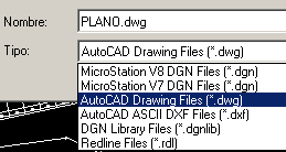
This course was oriented to the construction of data, the result of the workshop has been the creation of the roads and hydrology maps that they had to do using the cartographic sheet 1: 50,000 for the toponymy and the downloaded image to draw streets, rivers and streams. We built them with Microstation Geographics, then we did topological cleaning and nodes connection; finally export via "Fence file"for separate levels and conversion of v8 to v7 through the batch converter ... a whole religious experience as Enrique Iglesias would say.
The next course is in three weeks, when we expect to build the topographic, cadastral and soil layer. Also the application of data analysis and management with Manifold.
Finally, the last course will include the administrative, index and image layers in what the course should contain IMS service publication, creation of output layouts and data exchange with GvSIG, AutoCAD Map and Bentley Map.


Excellent Manifold I still remember the training I received ... the bad thing is that I was not invited again ...