3 news from Supergeo
From the creators of the SuperGIS model we get some news that is worth rescuing.
Fujairah Departments of Public Works and Agriculture Improve infrastructure sustainability with SuperGIS
 Fujairah is one of the United Arab Emirates, in the Middle East. They have decided to implement SuperGIS technologies for managing the life cycle of infrastructures, including asset management, process planning and data interaction between users.
It is interesting how CAD / GIS technologies are entering the management of public works beyond data management, in operation. And it is that public works are a fundamental and essential step in the economic development of a country; they connect our action with nature.
In one of my next trips I hope to take a look at this, because I would imagine it in the case of Bentley AssetWise that is almost ready for that, but customizing a tool that many of us have always associated with maps is… more than interesting. They will do it with SuperGIS Desktop 3.1 to serve data, just like Busolini and CONSTANTINI PROGETTI that in Italy complemented by implementing SuperSurv for street lighting management.
Additionally, it strikes me that this is the materialization of what we were able to visualize in the joint exhibition between SuperGeo and GeoSystems at the Middle East Geospatial Forum. An interesting aspect in which both the manufacturer and the service seller make an offer in which both benefit.
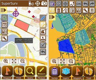
SuperSurv 3.1 SuperPad 3.1atan Google Maps / OpenStreetMaps as background map

Using Online Map Tools, these two tools allow a background map to be an online map, such as a Google Maps layer or OSM.
So then, if we mount a map of our production via SuperGIS server 3.1a, it is feasible to put it in the background when capturing or updating cartographic or topographic data, as is the case with SuperSurv.
More information on SuperSurv 3.1, http://www.supergeotek.com/LandingPage_SS3.1.aspx
You can also download a free version at http://www.supergeotek.com/download6mobile.aspx
SuperPad 3.1 a will be released in the third quarter of 201.
Next edition of SuperGIS will include Spanish language
One of the most attractive challenges of this software is its intention to come to the Spanish-speaking context. For this, we are pleased to report that they have included Spanish in its next version, with which we are sure many users and companies will be willing to enter software with the ability to compete globally. Although he was born in Taiwan, he has the good will to invest in our language; what deserves our respect.
Here you can see a long video of how it operates: